Menu

 EUR
EUR CAD
CAD AUD
AUD GBP
GBP MXN
MXN HKD
HKD CNY
CNY MYR
MYR SEK
SEK SGD
SGD CHF
CHF THB
THBMap Lot, Four Early Maps of New England, Cremona, Languedoc, and Bardowick, Germany.
Lot 480
About Seller
Bonhams Skinner
274 Cedar Hill Street
Marlborough, MA 01752
United States
Founded over four decades ago, Bonhams Skinner offers more than 60 auctions annually. Bonhams Skinner auctions reach an international audience and showcase the unique, rare, and beautiful in dozens of categories, including the fine and decorative arts, jewelry, modern design, musical instruments, sc...Read more
Categories
Estimate:
$700 - $900
Absentee vs Live bid
Two ways to bid:
- Leave a max absentee bid and the platform will bid on your behalf up to your maximum bid during the live auction.
- Bid live during the auction and your bids will be submitted real-time to the auctioneer.
Bid Increments
| Price | Bid Increment |
|---|---|
| $0 | $10 |
| $100 | $25 |
| $500 | $50 |
| $1,000 | $100 |
| $3,000 | $250 |
| $5,000 | $500 |
| $10,000 | $1,000 |
| $30,000 | $2,500 |
| $50,000 | $5,000 |
| $100,000 | $10,000 |
| $300,000 | $25,000 |
| $500,000 | $50,000 |
| $1,000,000 | $100,000 |
About Auction
By Bonhams Skinner
Nov 16, 2014 - Nov 17, 2014
Set Reminder
2014-11-16 10:00:00
2014-11-17 10:00:00
America/New_York
Bidsquare
Bidsquare : Fine Books & Manuscripts
https://www.bidsquare.com/auctions/skinner/fine-books-manuscripts-301
Bonhams Skinner bidsquare@bonhamsskinner.com
Bonhams Skinner bidsquare@bonhamsskinner.com
- Lot Description
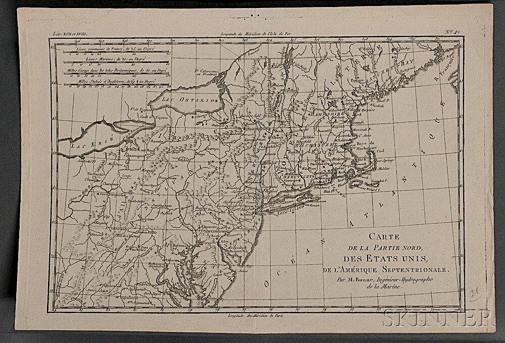
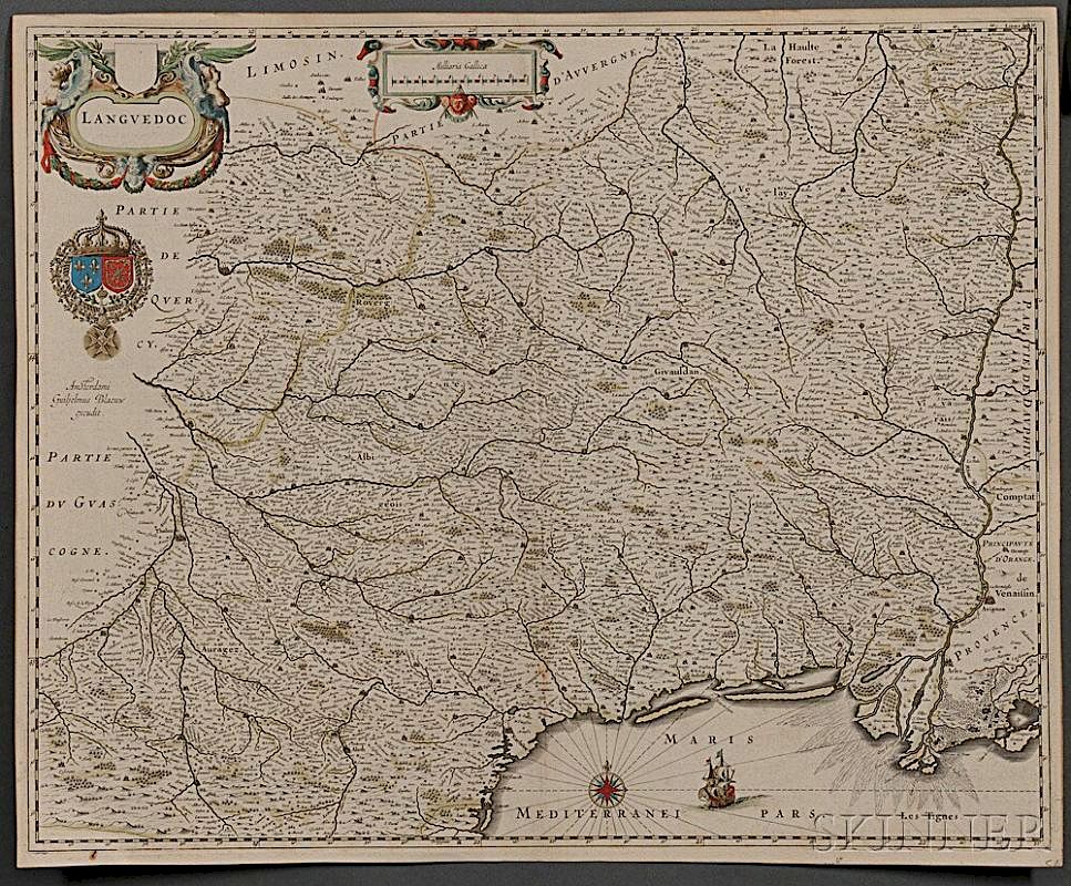
Map Lot, Four Early Maps of New England, Cremona, Languedoc, and Bardowick, Germany.
Rigobert Bonne's (1727-1795) Carte de la Partie Nord, des Etats Unis, de L'Amerique Septentrionale, [Paris, c. 1787], uncolored, central vertical fold, loss of thickness to paper from the verso when guard was stripped out, 14 1/2 x 10 in.
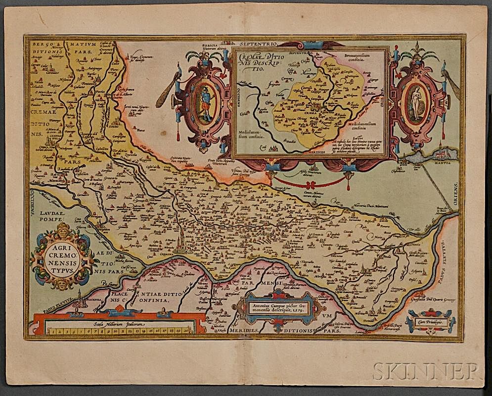
Antonio Campi's (1536-1591) Agri Cremonensis Typus, from Abraham Ortelius's Theatrum Orbis Terrarum, Antwerp, 1609, hand-colored engraving, two joined sheets, typographical text on verso of left sheet, some discoloration along the fold, spots, 21 1/4 x 16 3/4 in.
Willem Blaeu's Languedoc, Amsterdam, [c. 1635], very detailed engraved map of Southern France, hand-colored, typographical text on the verso in Dutch, 22 x 18 in.
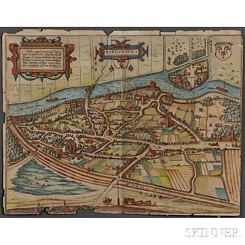
Daniel Friese's (1540-1611) Bardewick, Braun & Hogenberg, c. 1598-1618, hand-colored engraving, typographical text on the verso in Latin; extensive marginal chipping with loss, tears, delicate, 20 x 15 3/4 in.
[and] two other engravings.
Estimate $700-900
The absence of a condition statement does not imply that the lot is in perfect condition or completely free from wear and tear, imperfections or the effects of aging. Condition requests can be obtained via email (lot inquiry button) or by telephone to the appropriate gallery location (Boston/617.350.5400 or Marlborough/508.970.3000). Any condition statement given, as a courtesy to a client, is only an opinion and should not be treated as a statement of fact. Skinner Inc. shall have no responsibility for any error or omission. - Shipping Info
-
Please visit http://www.skinnerinc.com/services/payment-and-shipping/ for information regarding the collection of items purchased at auction.
-
- Buyer's Premium


