EUR
 CAD
 AUD
 GBP
 MXN
 HKD
 CNY
 MYR
 SEK
 SGD
 CHF
 THB
 SAR
 AED
Drawing the Line: The Maps and Documents That Shaped the Mason-Dixon Boundary
On October 29, 2026, Brunk Auctions will present Important Mason-Dixon Manuscript Map & Related Documents live on Bidsquare. At the center of the four-lot sale is the original manuscript map of the boundary between Maryland and Pennsylvania, drawn by Charles Mason and Jeremiah Dixon after years of surveying one of colonial America’s most complicated territorial disputes. But the story does not begin or end with that famous line. The auction brings together maps and printed documents that show how geography, politics, science, and even cartographic error helped determine where the boundary would fall.
Featured Auction Highlights:
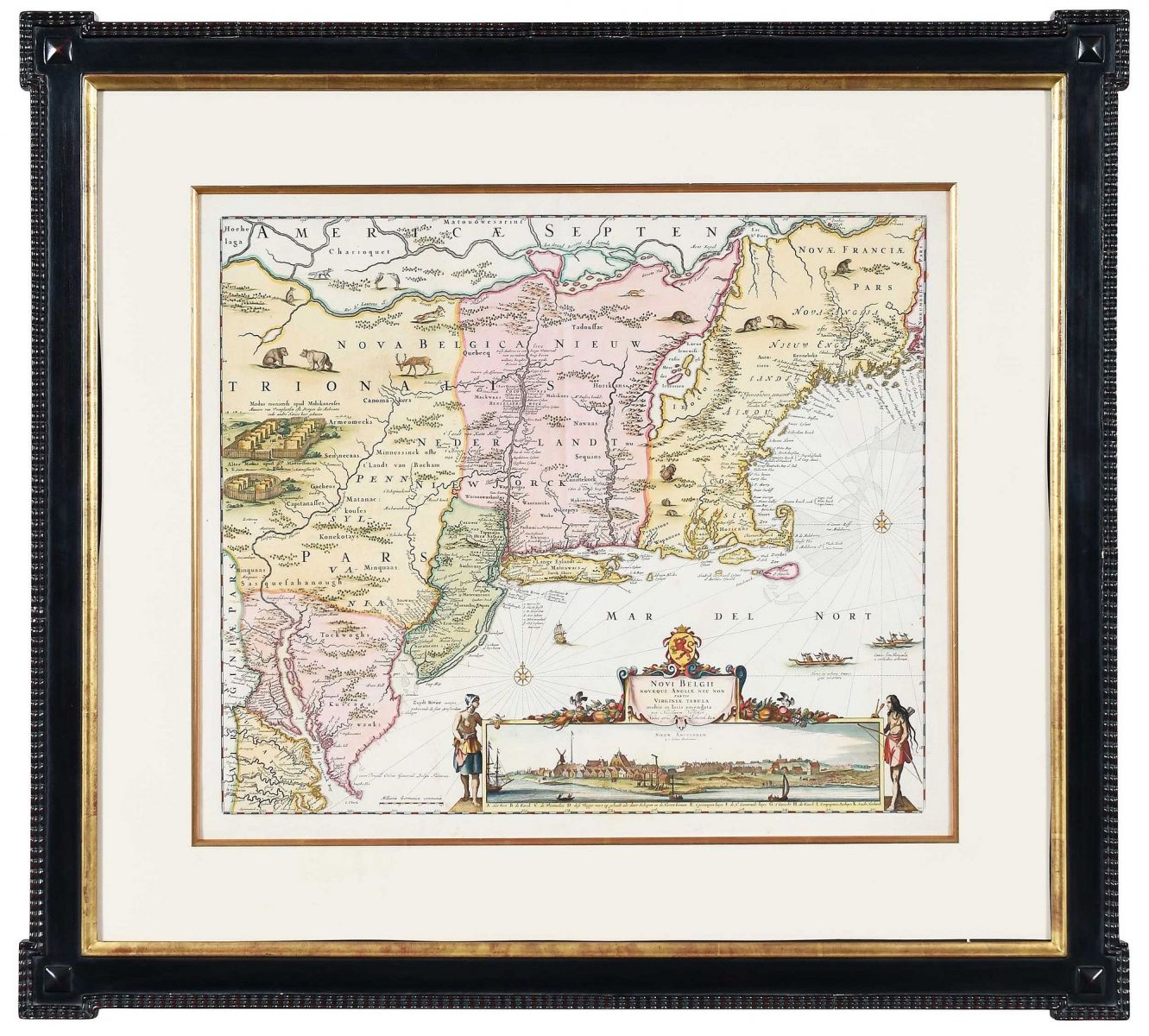
Nicolaes Visscher and Peter Schenk, Novi Belgii Novaeque Angliae nec non partis Virginiae Tabula (Lot 1)
The sale opens with a hand-colored map after Nicolaes Visscher, published by Peter Schenk in Amsterdam in 1729 or later. Beyond its visual appeal, the map played an unexpectedly consequential role in the Maryland-Pennsylvania dispute. Visscher placed Cape Henlopen farther south than its actual location, an error that influenced negotiations and ultimately cost Lord Baltimore thousands of acres. The map was used during the 1732 negotiations between the Calvert and Penn families. It also includes the celebrated inset view of New Amsterdam, one of the earliest engraved views of New York. Estimated at $3,000 - $4,000, the lot is a reminder that maps do not merely record history, they can help shape it.
Charles Mason and Jeremiah Dixon, A Plan of the West Line (Lot 2)
The centerpiece of the auction is the original manuscript plan of the west line separating Maryland and Pennsylvania, surveyed, drawn, and signed by Mason and Dixon. Created in Philadelphia between late 1767 and early 1768, the narrow sheet measures just 6 1/2 inches high but stretches 76 inches in length.
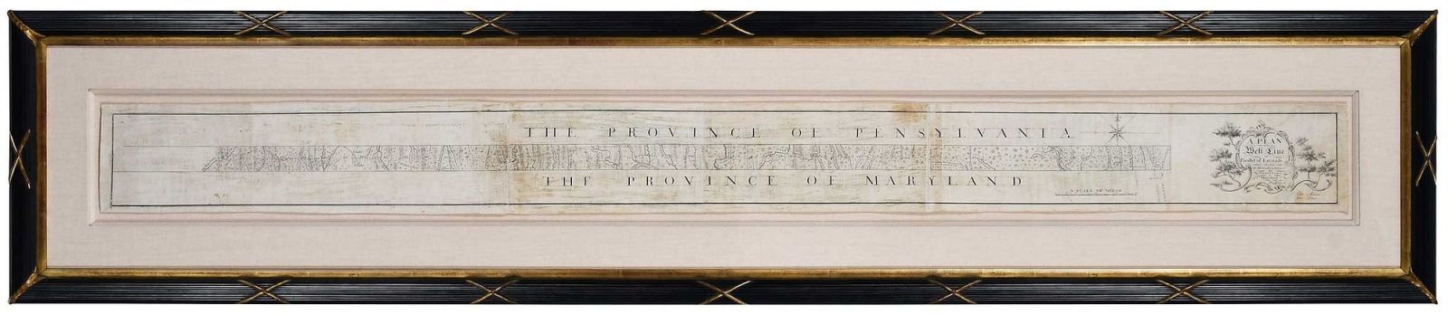
Mason and Dixon were selected for the task because of their astronomical and surveying expertise. Their work required years in the field, sophisticated instruments, difficult travel, and constant calculation. The map records the 233-mile west line and represents the culmination of the survey that finally resolved a dispute stretching back generations. Later, the Mason-Dixon Line acquired a broader cultural meaning as a symbolic division between North and South. With an estimate of $800,000 - $1,200,000, this manuscript is both a scientific document and a remarkable record of how politics, precision, and place became intertwined in American history.
Benjamin Franklin, Articles of Agreement (Lot 3)
Another key document takes the story back to the legal negotiations that preceded Mason and Dixon’s survey. Printed in Philadelphia by Benjamin Franklin in 1733, the Articles of Agreement sets out the terms reached between the proprietors of Maryland and Pennsylvania concerning their shared boundaries. The 18-page pamphlet is accompanied by a separately framed woodcut map.
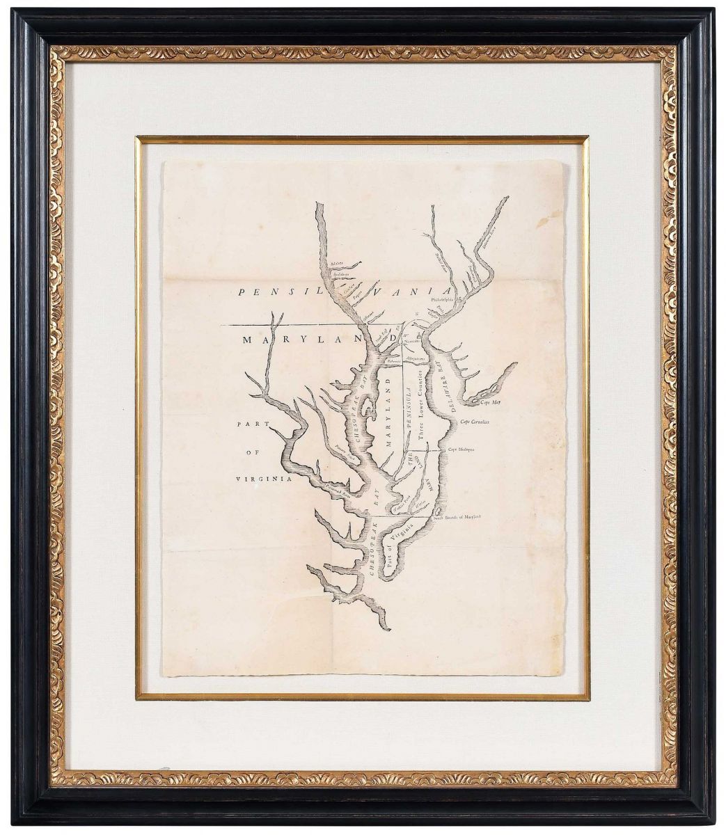
The agreement grew out of decades of failed attempts to settle the border. Each side submitted maps for reference, including the inaccurate Visscher map in the first lot. Franklin printed 500 copies of the agreement, each accompanied by a woodcut version of the map, and surviving examples are now exceedingly rare. Estimated at $60,000 - $80,000, the lot brings the legal and publishing history of the dispute into focus while showing Franklin at work as a printer in colonial America.
Bernard Romans, A Chorographical Map of the Country Round Philadelphia (Lot 4)
The final lot moves the story forward to the Revolutionary era. Bernard Romans’s map of the area around Philadelphia, published in Amsterdam around 1778, was based on an earlier map created to illustrate the Philadelphia campaign of 1777. It identifies Washington’s camp near Valley Forge, traces the route of British forces under General Howe, and records roads, waterways, place names, and political boundaries.
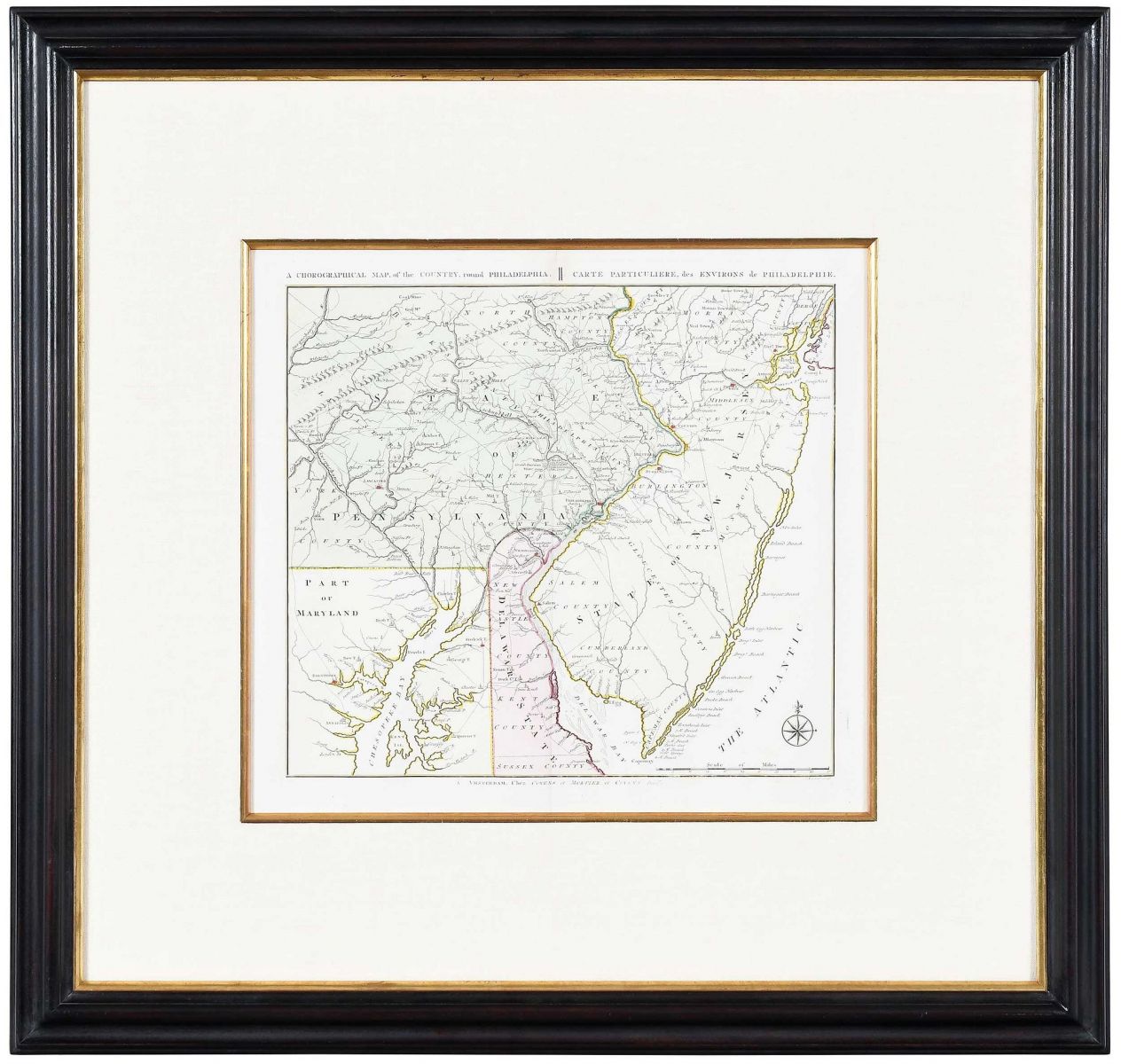
One detail is especially relevant to this sale: Romans included the eastern portion of the Maryland-Pennsylvania boundary surveyed by Mason and Dixon, including the circle around New Castle and part of the east-west line. The map shows how quickly the survey entered the cartographic language of the region. Estimated at $10,000 - $15,000, it connects the boundary story to the next major chapter of American history.
A Boundary That Became a Symbol
Taken together, these four lots tell a story larger than any single map. They trace the Mason-Dixon boundary from flawed geographic assumptions and legal compromise to scientific survey and its appearance on later maps of a changing nation. Brunk Auctions’ October 29 sale offers collectors a rare chance to encounter that history through the documents that helped create it, objects that show how a line on paper became one of the most enduring boundaries in the American imagination.
Register to bid on Bidsquare.com.
Similar Posts
-
 Every Second Counts, Yet Nothing Matters
-
 Drawing the Line: The Maps and Documents That Shaped the Mason-Dixon Boundary
-
 A Collector’s World in Miniature: Dollhouse Treasures at Auction
-
 Small Scale, Big Stories: Four Highlights from Beyond the Button
-
 A Life Collected: Art, Design, and the Beauty of Living with Objects
-
 Gameboards as Folk Art: Highlights from the Bruce and Doranna Wendel Collection
-
 Collected Character: Five Standout Lots from the Nancy Jo Fox Estate
-
 Through the Lens: Four Highlights from In Focus: A Distinguished Collection of Photography
- Every Second Counts, Yet Nothing Matters
- Drawing the Line: The Maps and Documents That Shaped the Mason-Dixon Boundary
- A Collector’s World in Miniature: Dollhouse Treasures at Auction
- Small Scale, Big Stories: Four Highlights from Beyond the Button
- Diamonds, Design, and Timeless Style: Highlights from an October Jewelry Auction
- A Life Collected: Art, Design, and the Beauty of Living with Objects
- Gameboards as Folk Art: Highlights from the Bruce and Doranna Wendel Collection
- Collected Character: Five Standout Lots from the Nancy Jo Fox Estate
- Through the Lens: Four Highlights from In Focus: A Distinguished Collection of Photography
- From Golden Age Heroes to Cosmic Showdowns: Four Comic Highlights to Watch